Dash
ConceptOverview
The moment you notice a road problem — a pothole that just rattled the car, a flooded lane, debris in the road, a streetlight that's been dark for weeks — is exactly the moment you can't do anything about it. You're driving. By the time you've parked and have a free hand, the location is a guess and the impulse is gone.
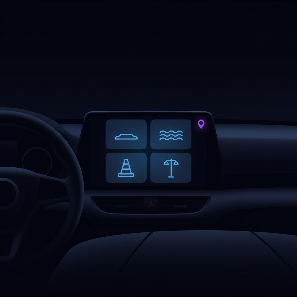
Dash puts a single, glanceable reporting action on the car's own screen. Through Apple CarPlay and Android Auto, the driver taps one of a few large hazard tiles — or just says "report a pothole" — and the car's GPS fixes the location at that instant. UnGovr resolves which agency is responsible for that stretch of road and routes the report, with no typing and eyes never leaving the road for more than a glance.
How it works
Designed for the driver's seat
- Glanceable, not browsable. A handful of large hazard tiles and a confirm screen — the whole task is a couple of taps, within the car platforms' strict limits on how much a driver can interact with while moving.
- Hands-free path. "Report a pothole" works by voice, so the report can happen without touching anything at all.
- Right agency, shown up front. Roads are a patchwork — a city street, a county road, and a state highway can be a block apart, and the same pothole belongs to a different agency on each. Dash shows who the report is going to before you send it.
- Works where signal doesn't. Coverage drops on rural highways and in canyons — exactly where road hazards hide. Dash is designed to resolve the responsible agency on the device, so the experience holds up even with no bars, and the report syncs once you're back online.
What you can report
The starting set is deliberately small — the hazards a driver can recognize and report safely in a single glance. The catalog can grow as the concept proves out.
Open questions
- Platform fit. Neither CarPlay nor Android Auto was built for civic reporting. Each has its own categories, review process, and constraints on what a third-party app may show on the car screen — Dash has to fit honestly inside them.
- Distraction safety. The bar is high, and rightly so. The flow has to be provably low-distraction: no free text, minimal steps, large targets, and a strong voice path.
- Duplicate reports. A bad pothole on a commute gets reported by many drivers. UnGovr needs to recognize and merge those into one issue for the agency.
- Right-of-way routing. Resolving the responsible agency for a precise point on a road — including state highways that have been handed off to a city — is the hard, interesting part, and the same engine the rest of the UnGovr Request family relies on.
Relationship to other UnGovr Request projects
Dash and Rumble both put road problems in front of the right agency, but from opposite ends: Rumble is machine telemetry — the vehicle's own sensors reporting automatically — while Dash is a person deciding to report what they just saw. Dash shares the same geocoding, jurisdiction lookup, and agency routing as Service Routing; what's different is the place it lives (the car's dashboard) and the constraint that shapes everything (the driver's attention belongs on the road).
Status
Concept stage, under active exploration in the lab. Have a perspective on in-car civic reporting, or work on a platform this should integrate with? Get in touch.