UnGovr Rumble
ConceptOverview
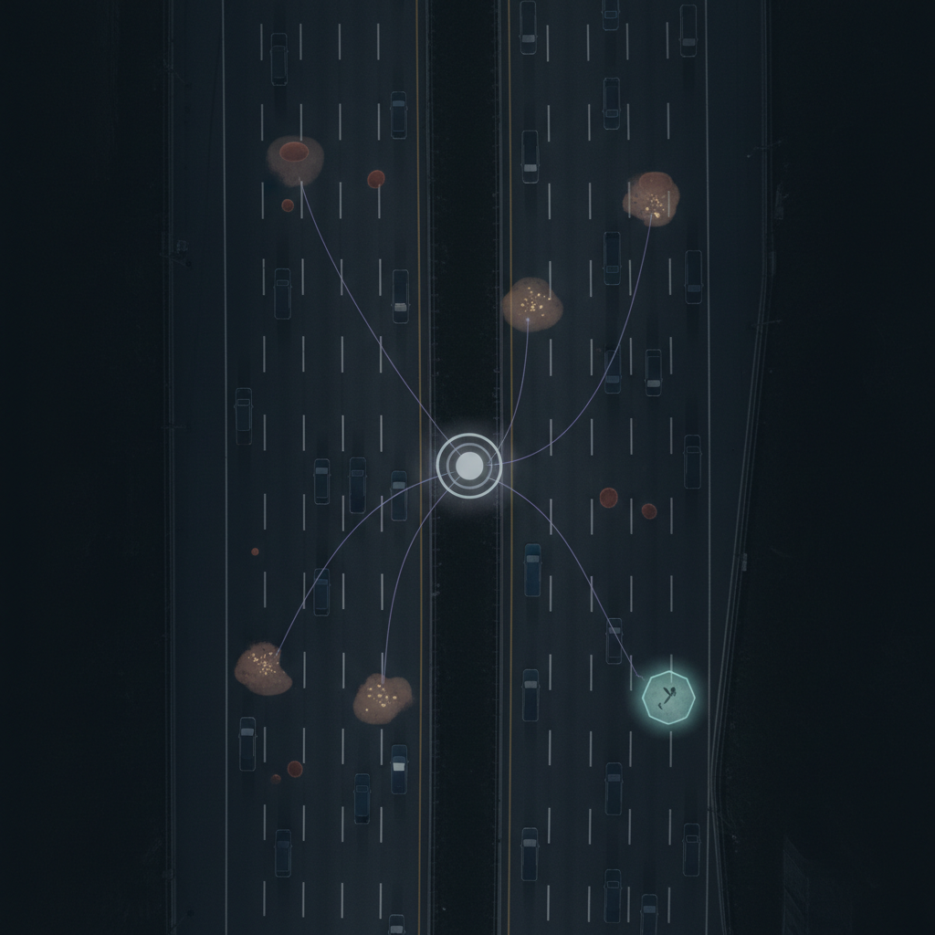
Car manufacturers already collect rich road surface data — suspension sensors measure pothole depth, cameras detect debris and hazards, and sonar maps fixed objects. This data improves future vehicles and mapping databases, but it rarely reaches the government agencies responsible for road maintenance.
UnGovr Rumble bridges that gap. Manufacturers send road events through a purpose-built API, and UnGovr handles the rest: spatial de-duplication clusters reports into unique issues, severity scoring prioritizes them, and UnGovr Request's geographic routing sends each issue to the right city, county, or state agency. Government gets one clean report per issue — not thousands of duplicate sensor readings.
For Manufacturers
Rumble accepts road events in formats native to vehicle telemetry — GPS coordinates, sensor type, measurements, and timestamps. No need to understand government service types or jurisdictions. UnGovr credits manufacturers on the Rumble Leader Dashboard.
For Government
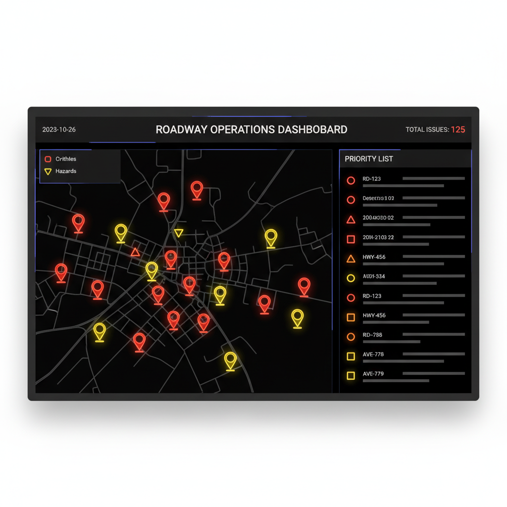
Road maintenance teams start each day with a prioritized dashboard. Issues are ranked by severity — combining sensor measurements with the number of vehicles that detected the problem. Click through to see full detail: dimensions, detection count, first/last reported, and which manufacturer(s) flagged it.
Manufacturer Leaderboard
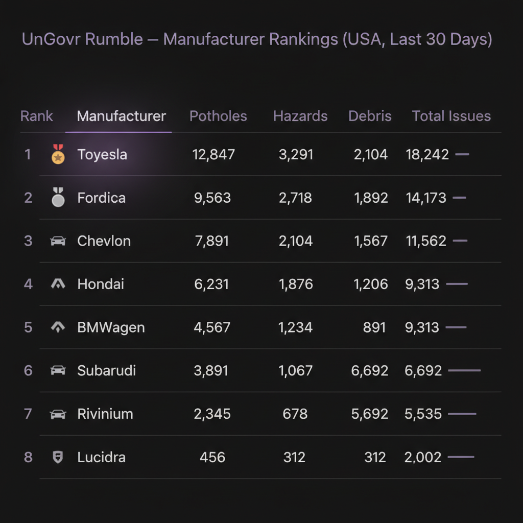
Every issue reported earns the manufacturer credit on the Rumble Leader Dashboard. Rankings are public — giving manufacturers a tangible incentive to participate and a way to demonstrate their commitment to road safety and civic infrastructure.
Why Manufacturers Participate
Manufacturers already collect road surface telemetry to tune adaptive suspension and ADAS. Rumble turns that sunk cost into measurable civic impact — with near-zero marginal effort.
- Leaderboard competition. Public rankings create a race. No manufacturer wants to be last — or absent — when competitors are reporting tens of thousands of road issues per month.
- ESG storytelling. “Our cars fixed 12,000 potholes last quarter” is concrete, verifiable impact — far stronger than a vague sustainability pledge.
- Regulatory positioning. Governments are moving toward connected vehicle mandates (V2X in the US, C-ITS in the EU). Voluntary participation now builds goodwill and shapes standards before regulators impose them.
- Better mapping products. Contributors could negotiate access to the aggregated, de-duplicated road condition layer — a richer dataset than any single fleet can produce alone.
- Liability reduction. If sensors detect a critical hazard and there’s a mechanism to report it, that’s a stronger position than recording it and doing nothing. Rumble provides the mechanism with an audit trail.
- Government fleet procurement. Municipalities buy vehicles too. A manufacturer that demonstrably helps cities maintain roads has an edge when fleet managers choose their next 200 police cruisers.
The Insurance Opportunity
Insurance companies are a natural catalyst for this ecosystem. They pay for bad roads — pothole damage, tire blowouts, and accident claims from road hazards cost insurers billions annually. A system that gets potholes fixed faster directly reduces claim volume.
As facilitators
- Subsidize participation. Insurers could offer premium discounts to manufacturers whose vehicles report to Rumble, or fund API integration costs. The ROI math is straightforward: if Rumble prevents X claims at $Y average cost, spending less than X×Y on the program is profitable.
- Expand coverage via telematics. Progressive, State Farm, and others already have OBD dongles collecting driving data for usage-based insurance. Those devices could contribute road condition signals — extending coverage to older vehicles without built-in sensors.
As data consumers
- Risk modeling. Knowing which road segments are deteriorating lets insurers adjust risk by geography. A commuter on a road with 15 unresolved critical potholes is a higher claim risk.
- Subrogation evidence. Timestamped, multi-vehicle-confirmed severity data is far stronger evidence for recovering pothole damage claims from responsible agencies.
- Municipal insurance pricing. Insurers who underwrite municipal liability could use Rumble data to price policies more accurately — or require participation as a risk mitigation condition.
The value loop
Manufacturers contribute sensor data → Rumble de-duplicates and routes to agencies → agencies fix roads faster → insurers see fewer claims → insurers fund manufacturer participation → more manufacturers join.
Potential Partners
Rumble is designed to work with organizations already investing in road intelligence. Several real-world programs demonstrate the demand for exactly this kind of infrastructure.
- Toyota Mobility Foundation. Awarded San José a $260,000 grant for AI/computer-vision roadway hazard detection, achieving 97% pothole detection accuracy in its pilot. A Rumble sponsorship could extend this beyond potholes to sidewalk debris — dumped furniture that blocks wheelchair users, people with mobility impairments, and those with vision impairments.
- Honda. Partnered with Ohio DOT to use onboard cameras and lidar to detect potholes, damaged signs, guardrails, and road roughness across roughly 3,000 miles of Ohio roads. The data flowed directly to ODOT — the same government-first routing model Rumble provides at scale.
- Caltrans. The Connected and Automated Vehicles (CAV) program is actively investing in technology-driven infrastructure monitoring across California’s 50,000+ centerline miles of state highway. Rumble could serve as the crowdsourced complement to Caltrans’ own sensor and inspection programs.
- USDOT ATTAIN/ATTIMD. Federal deployment grants specifically designed for model deployment sites with quantifiable objectives and public/private partnerships. Program language emphasizes projects that become scalable examples integrated into routine operations — a direct match for Rumble’s architecture.
How It Works
→ parse 142 road events from 3,847 vehicles
→ classify pothole(87) hazard(31) debris(24)
→ dedup 142 events → 38 unique issues (spatial clustering)
→ score critical(3) high(12) medium(15) low(8)
→ route City of Ventura PWD (14) | Caltrans D7 (9) | County PW (15)
✓ 38 issues routed to 3 agencies